  |
 |
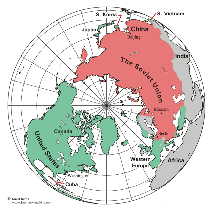
The map below is a North Polar Projection map. It is
especially helpful for showing the great extent of communist
systems around the world during the Cold War era.
South Vietnam, shown in green here, was non-communist
until it was taken over by North Vietnam in 1975.
 |
 |
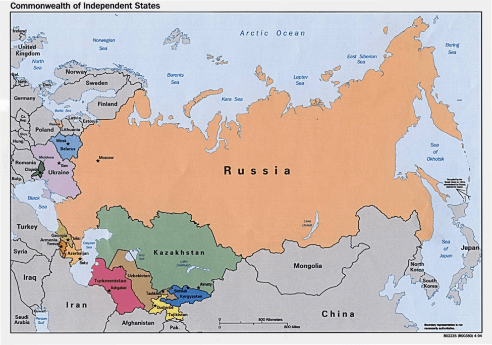
The map below shows the former countries of the Soviet Union (USSR)
that formed a cooperative organization when the Soviet Union and the Warsaw
Pact ceased to exist in 1991. The map shows the participants in the organization,
called the Organization of Independent States, in the 1990s.
Lithuania, Latvia, and Estonia were also part of the old
Soviet Union, but did not become part of the organization.
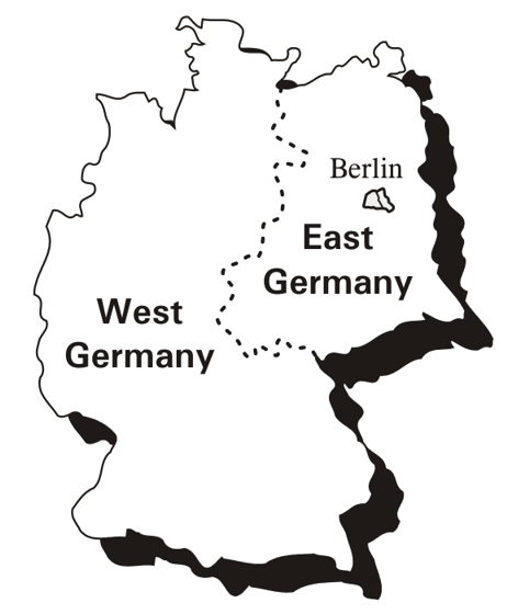
The map below shows how Germany was partitioned (divided)
into West Germany and East Germany after World War II ended in 1945.
Berlin, the capital of Germany, was also divided, even though
it was entirely within the East German (communist) side.
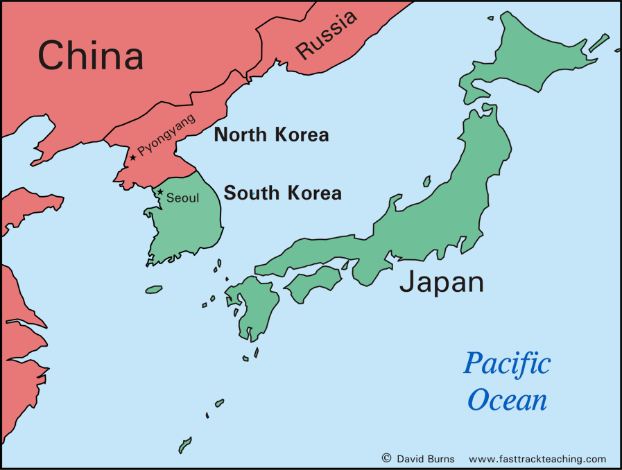
The map below shows North and South Korea. The country
was divided at the end of World War II. The Soviet Union installed
and supported a communist government in North Korea, while
South Korea was non-communist and supported by
the United States.
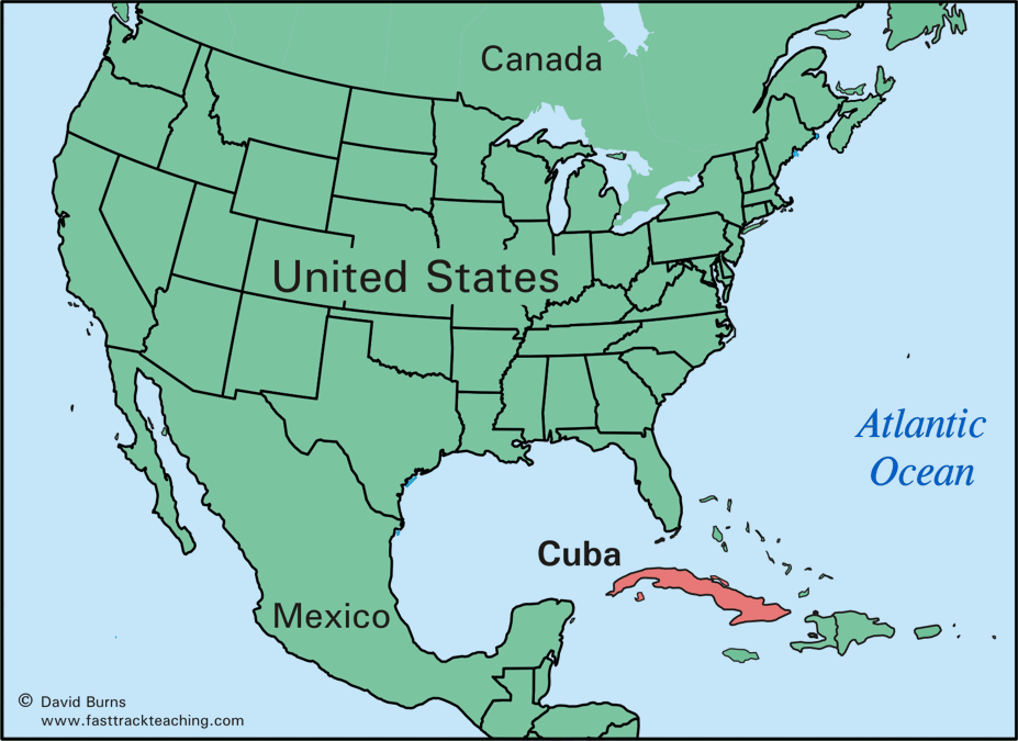
The map below shows Cuba, which became a communist country in
1960 and formed a close alliance with the Soviet Union.
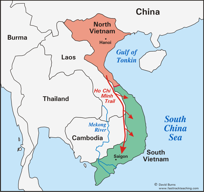
The map below shows Vietnam and its division in the 1950s into
North Vietnam (communist) and South Vietnam (non-communist).
The Ho Chi Minh Trail was the route through the jungles that
North Vietnamese fighters traveled to attack South Vietnam.
 |
 |
All maps except the Commonwealth of Independent States
are by David Burns. The Commonwealth of Independent States
map is a public domain image from the U.S. Central Intelligence Agency.
|
Copyright Notice
Copyright 2011, 2019 by David Burns. All rights reserved. As a guide to the Virginia Standards of Learning, some pages necessarily include phrases or sentences from that document, which is available online from the Virginia Department of Education. The author's copyright extends to the original text and graphics, unique design and layout, and related material. |