| Fasttrack
to America's Past Teacher Key |
|
| Fasttrack
to America's Past Teacher Key |
|
 Page 50  Page 51 |
Pages 50
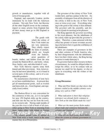
& 51 - A Visit to the Middle Colonies The reading selection The main theme in this reading selection is the remarkable development of the colonies economically, socially, and politically by 1750. The account by the Swedish visitor Peter Kalm notes the growth of the population in the first half of the 18th century. He describes the prosperous farms and orchards he saw while traveling through New Jersey and Pennsylvania. He notes that few Indians remain in the eastern parts of the colonies, although his line that "The Indians have sold the country to the Europeans, and have retired further up" is, of course, not the full story. An interesting part of the selection describes the acceptance of Jews in New York. (Several other colonies also had Jewish communities.) In most parts of Europe, Jews still faced hostile prejudice and legal restrictions of various kinds. Peter Kalm's account shows that religious tolerance was already becoming part of the American experience. New York City is described as the leading commercial center of the colonies, and Kalm notes the importance of this trade to England and especially London. Kalm also describes the balance of political power between the royal governor and the colonial assembly. Despite the governor's link with the king, the assembly clearly played a major role in discussing and resolving issues in the colony. The pictures The drawing on page 50 shows a man sprinkling seeds on a field. Over 90 percent of colonists lived on farms, and even merchants, shopkeepers, and lawyers often also kept a small farm. The drawing on page 51 of a ship and waiting cargo is a reminder that even in the Colonial era, New York was an important trading center.
1. The Swedish visitor Peter Kalm described the areas he saw as remarkably prosperous. He writes of "very extensive cornfields" and large orchards. The orchards were so productive that fallen fruit covered the ground in some of them. Farm owners apparently allowed travelers to help themselves as they passed by. (At this time, of course, it was difficult to preserve large quantities of fruit. As a result, harvest time brought a surplus that could not easily be kept.) 2. When he reached New York, Peter Kalm noticed that the Jewish community was accepted, and had built their own synagogue. He says the Jews "possess great privileges," although what he means is the same privileges "common to the other inhabitants." His word choices show his awareness that in many of European countries, Jews still faced restrictions that governed where they could live and what businesses and trade they could conduct. 3. Peter Kalm makes a number of interesting observations about trade between the colonies and England. He notes that the trade was extensive, and was clearly benefiting both sides.New York, in particular, had emerged as an important colonial shipping port, and even had a small shipbuilding industry. Natural resources such as timber, animal skins, and iron were exported, along with farm products like wheat and oats. (Kalm uses the word "corn" as many Europeans do, to describe any of the grain crops.) Manufacturing had not developed to any great extent when Kalm visited New York. Such products were mostly imported from England, and especially London. 4. The colonial government in New York is described by Peter Kalm as a system that involved a balancing act between the colonial assembly and the royal governor. Certainly the governor, representing the king, had wide powers. He could call up the assembly, or end its meetings, "at his pleasure." However, Kalm says the assembly is where "Everything relating to the good of the colony" is debated. Kalm also notes that, as a practical matter, the assembly had a financial hold over the royal governor. The assembly could refuse to pay the governor's salary. The system, as described by Kalm, seems to give a clear political advantage to the colonists. |
|
Copyright Notice
Copyright 2018 by David Burns. All rights reserved. Illustrations and reading selections appearing in this work are taken from sources in the public domain and from private collections used by permission. Sources include: the Dover Pictorial Archive, the Library of Congress, The National Archives, The Hart Publishing Co., Corel Corporation and its licensors, Nova Development Corporation and its licensors, and others. Maps were created or adapted by the author using reference maps from the United States Geological Survey and Cartesia Software. Please see the home page for this title for more information. |