|
U.S.
map regions and the 50 states
There
are several ways to divide
the U.S. map and the 50 states into regions.
The maps below shows one common way to do it. Note: The partially completed versions of these maps, ready for your students to add color shading, are in the Appendix section of your Frameworks for America's Past master page binder. |

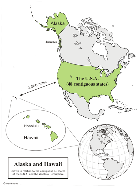
What exactly is the Noncontiguous region?
Noncontiguous
means "not
connected." The Noncontiguous region of the United States
consists of Alaska and Hawaii, as the map on the right
shows.
Notice that Alaska is nowhere near Hawaii. So why are they often shown together in the corner of so many maps of the U.S.? That just makes it easier to show all 50 states on one page. Notice also that Alaska is far and away the largest state - over twice as large as Texas! Many people don't realize that, because many maps of the U.S. (like the one above) shrink the size of Alaska to 1/2 scale. Again, that's just done so all the states can be shown conveniently on one page. Juneau is the capital of Alaska. Honolulu is the capital of Hawaii. |
 |
|
Review
map - the regions and states
Use
the map below to quiz yourself as you
learn the regions and states.
It is also fun to play the 50 States computer games linked from the main page of this section. |

|
Copyright Notice
Copyright 2010, 2023 by David Burns. All rights reserved. As a guide to the Virginia Standards of Learning, some pages necessarily include phrases or sentences from that document, which is available online from the Virginia Department of Education. The author's copyright extends to the original text and graphics, unique design and layout, and related material. |