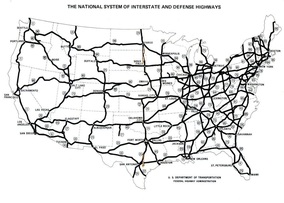
| The Interstate
Highway System Frameworks for America's Past |
|
|
Copyright Notice
Copyright 2012 by David Burns. All rights reserved. As a guide to the Virginia Standards of Learning, some pages necessarily include phrases or sentences from that document, which is available online from the Virginia Department of Education. The author's copyright extends to the original text and graphics, unique design and layout, and related material. |